Aircraft observations are improving weather model forecasts
Using aircraft observations for weather models was suspended in 2022 but has made a return.
NASHVILLE, Tenn. (WSMV) - Weather model forecasts are improving — thanks to planes.
Weather models rely on observations from sensors across the globe, such as buoys in the ocean, weather stations, and, in this case, aircraft.
For a model to have accuracy, it must have data ingested into it that helps set the initial conditions the model will use to make its forecast.
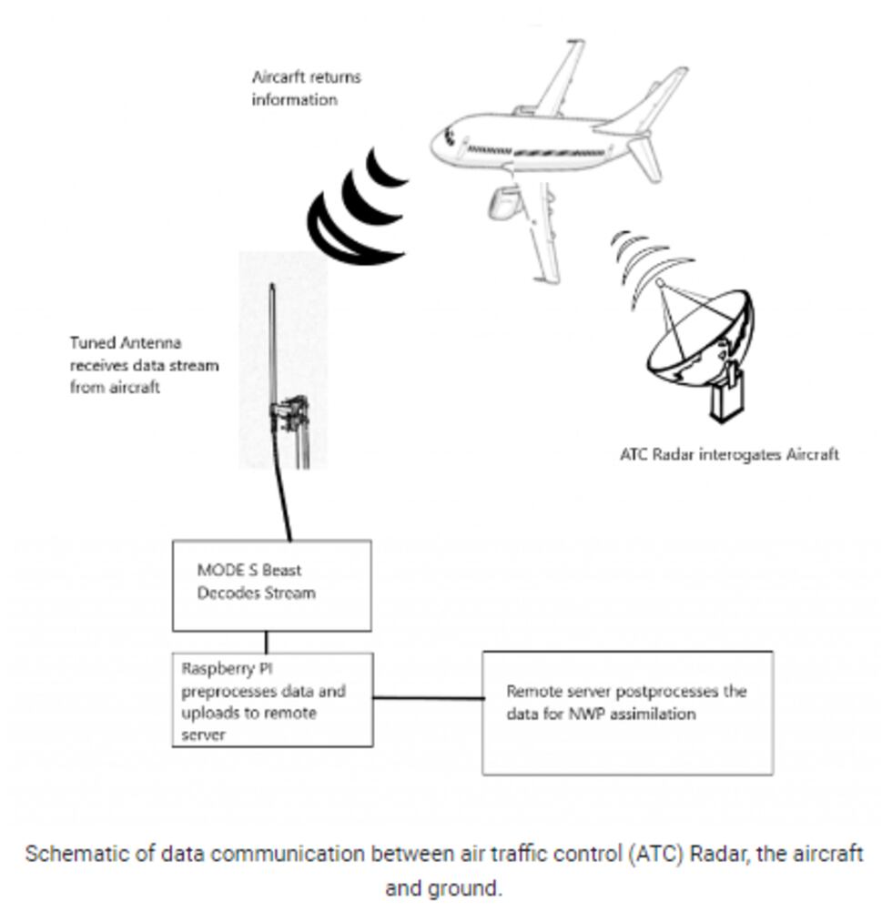
The European Centre for Medium-Range Weather Forecasts (European Model - ECMWF) is now using aircraft observations to help make the initial conditions the model uses more accurate. This method for collecting data from aircraft for numerical weather prediction is known as Mode-S.
According to ECMWF, the use of Mode-S data was suspended in November 2022.
Mode-S data is derived from air traffic control data. The raw data the aircraft gathers has to be processed to be usable in weather model runs.
According to ECMWF, upper tropospheric wind forecasts over Europe are up to 8% more accurate since using the Mode-S method at short range. Even 1% better in accuracy helps, but 8% is significant!
The ECMWF says when initially using Mode-S observations — from 2020 to 2022 — they were using too many observations. They’ve now found a way to process the data and use it more beneficially.
Copyright 2024 WSMV. All rights reserved.